8.30am - Last night was probably a night that I slept like a log. Althought the altitude was still above 3,000, the drop in height from Tashi Chil was significant enough to give me a restful night. I woke up brushing my teeth to the view of a misty morning but with a sun that was helping to warm things up.

View from the corridor outside my room

Crossing the bridge over Dzachu in Dzato town

A view of dusty cowboy town Dzato

Restaurant serving Szechuan cuisine - our breakfast joint before we set off

View across one of the Dzachu tributaries near Dzato town

Leaving Dzato County gate behind

To search for blue skies and mountain passes

We found the blue skies... and juniper trees

Pema collecting a branch with its dark green fruits
Painting of a buddha on a rock face by the road
With scriptures accompanying to bless the area

Tong Ren La Ka Ya mountain pass. Elevation 4760m

Latse and prayer flags at the pass

Snow filled ditches in the marshy plains

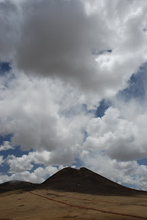
Amazing cloud formations at high altitudes

Going to the edge

Three Latse (prayer flags) marking the Chang La San mountain pass

Prayer flags frame snow-capped mountains in the distance

Prayer flags partially covered by snow on the ground

A nomad's house at the foot of a snow back mountain

Clouds fill the space in the valleys

A cloud sails above a knoll

One of three bald vultures scavenging for a meal

Soaring through the crips mountain air

A stupa aglow in the rays of the sun

Ren La Ren San mountain pass. Elevation 4505m

Colourful prayer flags sends blessings into the wind

"Mani" stones bask in the sun
The other road user

Clouds drift over the top of mountain ranges

Dashes of white on a blue sky canvas

Long road ahead with only the elements for company

Hundreds of prayer flags stand tall like troops protecting the land

Yaks graze the open fields

The mountains part to let a river flow
The final stretch before Jyekundo
2.30pm - We arrive in Jyekundo and checked into the same Guesthouse as a few days before. The landlady wasn't there but a young assistant checked us in. We took the same room, while Mr Shi shifted to the room next to ours.
2.45pm - Hungry, we went across the street for a hearty lunch of vegetables (Shang Hai Qing), beef trips with pepper, egg omelette with tomatoes, stir-fried Bai Cai with Mushrooms, and a big bowl of noodles. The meal was excellent and we were stuffed.
4pm - After lunch, Pema and I went to a nearby bookstore in search for books that detail the location of Taschi Chil but couldn't find anything useful apart from a pictorial book containing maps of Qing Hai province. Feeling ill, Pema left me to my own devices where I decided to hunt around for a Wang Bar (Internet Cafe). I found one about 10 minutes from the Guesthouse
5pm - after fumbling about with the terminals, I found one which actually worked and allowed me to upload pictures onto my blog. I'm a happy man. I did have much time because Mr Shi had arranged to pick me up to send me to a nearby monastry famous for their "mani" stones and so I uploaded what I could and then hurried off to meet Mr Shi at 6.30pm.


3 comments:
Do they make their own dye? The paintings on the stones/rocks are brightly coloured.
And nice shots of the blue skies.
This post, reminds me alot of Geog lessons. Haha. Atmospheric conditions, mountains, rocks and landforms. (!!)
Painting of the Buddha known as
---Guru Vajrasattva---
Above the crown of my head is Guru Vajrasattva, white in colour, adorned with jewels and ornaments.
With one face and 2 arms, holding a Vajra on his right and a bell on his left seated in a Vajra posture.
Post a Comment